- 1Tamatea/Dusky Sound is a remote southern fiord with no road: DOC says its heritage sites, Astronomer's Point and Pigeon Island, are reached only by boat.
- 2Cook named it 'Dusky Bay' in 1770 and returned in 1773. DOC's pages differ on how long he stayed: five weeks on three pages, six weeks on its southern fiords page.
- 3The Dusky Track is DOC's advanced tramping track between Lake Hauroko and Lake Manapouri: 84 kilometres one way, 8 to 10 days, with 21 three-wire bridges.
- 4Lake Hauroko and Lake Monowai are the southern lakes you can drive to. DOC says the Borland Road beyond Monowai is unsealed, narrow and steep in places, and not suitable for campervans, caravans or trailers.
01 / Start with the answer
What is southern Fiordland?
The far south of the park: Tamatea/Dusky Sound and its islands, the Dusky Track, and Lakes Hauroko and Monowai, reached by boat, air or a long unsealed road.
DOC says a fiord is where the sea partly fills steep-sided valleys once dug out by glaciers, and the fiords in Fiordland have a water depth of up to 440 metres. Most of them are named 'sounds', Tamatea/Dusky Sound among them, though DOC notes that 'sound' is a general, non-technical term. The southern fiords area has hundreds of islands, from small rock stacks up to Resolution Island at 20,860 hectares. There is no road to Tamatea/Dusky Sound: DOC lists a boat with a tourist operator or your own vessel for its heritage sites, and floatplane or helicopter to Supper Cove. By road you can reach two southern lakes: Lake Hauroko, which DOC gives as the deepest in New Zealand at 462 metres, and Lake Monowai at the start of the Borland Road. Everything here is from DOC's own pages. This guide gives no boat or flight fares, timetables or availability.
02 / At a glance
Which southern places can I reach, and how?
Only the lakes by road; the sound, its islands and its heritage sites by boat or air, or on foot over many days.
| Place | What DOC says | How you get there |
|---|---|---|
| Tamatea/Dusky Sound | Named 'Dusky Bay' by Cook in 1770; site of Cook's 1773 stay | Boat, or floatplane or helicopter to Supper Cove |
| Astronomer's Point, Pickersgill Harbour | Site of the 1773 observatory; one of the most visited historic heritage sites in Southland | Only by boat |
| Pigeon Island, Richard Henry's house site | Registered as a Category I Historic Place | Only by boat, with a tourist operator or your own vessel |
| Resolution Island | 20,860 hectares; New Zealand's first sanctuary, chosen in 1891 | Not given on the DOC pages used here |
| Dusky Track | 84 kilometres one way, 8 to 10 days, advanced tramping track | Boat on Lake Manapouri or Lake Hauroko, or by air |
| George Sound Route | 17.8 kilometres one way, 3 to 4 days, expert route | Transport across Lake Te Anau |
| Lake Hauroko | Deepest lake in New Zealand, 462 metres | From Tuatapere, about 36 kilometres to the car park, 20 of them unsealed |
| Lake Monowai and the Borland Road | About 67 kilometres (1 hour) from Te Anau | By the Southern Scenic Route |
03 / Cook at Tamatea
What did Cook do in Dusky Sound, and how long did he stay?
He anchored in Pickersgill Harbour in 1773, set up an observatory and a brewery, and charted the sound. DOC's pages give five weeks or six weeks for the stay.
DOC says Captain James Cook first sighted the fiord on his first voyage in 1770 and named it 'Dusky Bay'. On his second voyage he sailed the Resolution into Tamatea/Dusky Sound in the autumn of 1773 and anchored in Pickersgill Harbour. At Astronomer's Point, William Wales of the Board of Longitude set up a temporary observatory to fix the position of New Zealand. Cook was testing Larcum Kendall's copy of John Harrison's chronometer H4, and DOC says Wales's observations made New Zealand the most accurately located place on the globe at that time. Cook also set up a brewery using rimu and manuka leaves, hoping the beer would help prevent scurvy, and produced the first highly accurate chart of the sound. Some of western science's first records of New Zealand plants and animals, including weka, kereru, kākā and South Island robin, came from this stay. DOC says he sailed on 29 April 1773, by the Acheron Passage and Breaksea Sound. How long was he there? DOC's park page, its history and culture page and its Astronomer's Point page each say five weeks. DOC's southern fiords page says six weeks. DOC does not explain the difference, so we give both with their pages rather than pick one.
04 / Richard Henry
Who was Richard Henry, and why does Resolution Island matter?
The caretaker of New Zealand's first island sanctuary, whose bird transfers failed when a weasel arrived but still shape kākāpō recovery.
DOC says Resolution Island was chosen in 1891 as New Zealand's first sanctuary, and Richard Henry was appointed its caretaker and curator in 1894. He lived on Pigeon Island, and DOC calls him the international pioneer of moving live birds to island refuges. In his first six years he moved over seven hundred kākāpō and kiwi from the mainland to Resolution Island and nearby islands. Then, DOC says, he saw a weasel on Resolution Island on 4 August 1900. He stayed and trapped, but left in 1908 to become a ranger on Kapiti Island. The project failed, but DOC says his observations helped modern bird conservation, especially kākāpō recovery, and in 2008 DOC began a new eradication project so endangered birds could return to the island. DOC lists the nature reserve on Resolution Island among the sound's New Zealand firsts, alongside an observatory and brewed beer in 1773 and a European settlement and ship built in 1792.
05 / The Dusky Track
How do I plan the Dusky Track?
Only if you are an experienced, well equipped tramper: DOC grades it advanced, allows 8 to 10 days and says being stranded for 2 days is not uncommon.
- 01Check it suits you.
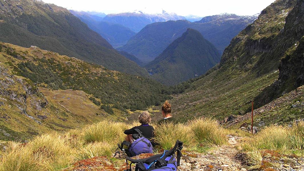
DOC describes the track between Lake Hauroko and Lake Manapouri as difficult, with huge lakes, rivers, forested valleys and lots of mud, for experienced and well equipped trampers. It is 84 kilometres one way and 8 to 10 days.
- 02Choose your direction and transport.
It can be walked either way. DOC's page lists boat services on both lakes, Lake Manapouri to West Arm at the north end and Lake Hauroko at the south, and flights to Supper Cove or Lake Hauroko; ask the visitor centre what runs when you go.
- 03Pack for delays.
Take extra food and time: DOC says being stranded for 2 days is not uncommon. It strongly recommends a personal locator beacon or satellite messenger and topographical maps.
- 04Expect wire bridges.
DOC says there are 21 three-wire bridges to cross. Between the Bishop Burn and the Henry Burn the track is flat and follows a track cut by West Coast miners in 1903.
- 05Know the highlights.
DOC calls the open tops of the Pleasant Range, between Lake Roe and Loch Maree huts, the scenic highlight, with views of Tamatea/Dusky Sound. The steep climb to Centre Pass (1051 metres) looks over Gair Loch, Tripod Hill and the Seaforth Valley. A two day optional detour goes to Supper Cove.
- 06Not in winter.
DOC says that in winter the track is often impassable and dangerous because of snow, ice and avalanches.
06 / Beyond the sound
What about George Sound, Lake Hauroko and Lake Monowai?
An expert route to George Sound from Lake Te Anau, and two southern lakes you can drive to, one of them at the foot of an unsealed alpine road.
Expert
George Sound Route
Deepest
Lake Hauroko
Road
Lake Monowai and the Borland Road
Landslide
From Borland Saddle
07 / Boats and the marine area
What do I need to know before taking a boat in?
Every vessel, even a kayak, needs a Clean Vessel Pass to enter the Fiordland Marine Area, under Environment Southland's rules.
The rules at sea are not DOC's to enforce, but DOC's pages explain them.
- A Clean Vessel Pass.
DOC says any vessel, even a kayak, entering the Fiordland Marine Area must hold a Clean Vessel Pass.
- Why it exists.
The Fiordland Marine Pathway Plan protects the area from marine pests carried in on boats, with rules for all vessels entering within one nautical mile of the landward boundary of the Fiordland Marine Area.
- Who sets it.
DOC says the plan is an Environment Southland regulation; DOC has no authority below mean high tide except in marine reserves or for marine mammals, and does not enforce fishing regulations.
- Preservation Inlet's past.
DOC says Preservation Inlet was home to over 2,500 gold miners and saw millers in the late 1890s, and was the site of one of New Zealand's most remote lighthouse settlements and its first whaling station.
Taking a kayak or fishing gear in?
Our fishing, hunting and freshwater pests guide covers DOC's Check, Clean, Dry rules and the Clean Vessel Pass for any vessel entering the Fiordland Marine Area.