- 1DOC says Milford Sound / Piopiotahi is in the northwest of Fiordland National Park, stretches 16 kilometres to the open sea and is 265 metres deep in places; Visit Fiordland gives the same length. DOC's kayaking page heads its Milford paddling section 18 km, without saying what that figure measures.
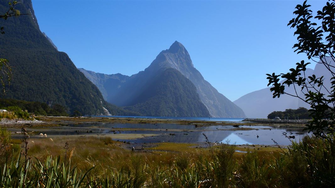
- 2DOC says Mitre Peak has sheer rock walls rising 1,692 metres directly from the water.
- 3In DOC's words, the Māori name Piopiotahi comes from the native thrush, the piopio, now probably extinct. DOC says the English name was given by sealing captain John Grono after his birthplace, Milford Haven.
- 4DOC says Piopiotahi (Milford Sound) Marine Reserve is one of 10 marine reserves in Fiordland.
01 / Start with the fiord
What is Milford Sound?
A fiord in the northwest of Fiordland National Park, 16 kilometres long by DOC's Milford Road page (its kayaking page heads the Milford section 18 km) and 265 metres deep in places.
DOC says Milford Sound Piopiotahi is in the northwest of Fiordland National Park, and that it stretches 16 kilometres to the open sea and is 265 metres deep in places. Visit Fiordland gives the same length, saying the sound runs 16 kilometres to the Tasman Sea. DOC's kayaking page heads its Milford paddling section 18 km, without saying what that figure measures. We give both by page. DOC says fourteen fiords, some stretching up to 40 kilometres inland, extend from Milford Sound Piopiotahi in the north to Preservation Inlet in the south, and gives the size of the national park around them as over 1.2 million hectares.
02 / In figures
How big is the fiord, by source?
DOC's Milford Road page gives 16 kilometres long (its kayaking page heads the Milford section 18 km) and 265 metres deep in places, with Mitre Peak rising 1,692 metres from the water.
| Feature | Figure | Source |
|---|---|---|
| Where it is | In the northwest of Fiordland National Park | DOC |
| Length | 16 kilometres to the open sea | DOC Milford Road page and Visit Fiordland; DOC's kayaking page heads its Milford section 18 km |
| Depth | 265 metres in places | DOC |
| Freshwater layer | Permanent, from 5 centimetres to over 10 metres deep in the fiords, stained by tannins | DOC marine reserves page |
| Life on the walls | A concentrated 40 metre band of unusual marine life below the freshwater layer | DOC Milford Road nature page |
| Black coral | About 7 million colonies in the fiords, some up to 200 years old | DOC marine reserves page |
| Mitre Peak | Sheer rock walls rising 1,692 metres directly from the water | DOC |
| Fiordland's fiords | Fourteen, some stretching up to 40 kilometres inland | DOC |
| Marine reserves | Piopiotahi (Milford Sound) Marine Reserve is one of 10 in Fiordland | DOC |
| Fiordland National Park | Over 1.2 million hectares, declared a World Heritage Area in 1986 | DOC |
03 / The names
Where do the names Piopiotahi and Milford Sound come from?
DOC says Piopiotahi is named after the native thrush, the piopio, and that Milford Sound was named by John Grono after his birthplace, Milford Haven.
In DOC's words, the Māori name for Milford Sound is Piopiotahi, after the native thrush, the piopio, now probably extinct. This guide repeats only what DOC says about the name and adds no story or translation of its own. DOC says the English name was given by a Welsh sealing captain, John Grono, after his birthplace, Milford Haven. DOC gives no date for the naming, so we do not give one either.
04 / What you see
What makes the fiord stand out?
Mitre Peak, the marine reserve and the scale of the national park around it, each described here in DOC's words.
Each card is from DOC.
Mitre Peak
The marine reserve
The national park
05 / Under the surface
What lives under the surface of the fiord?
DOC says a tea coloured freshwater layer sits on the sea water, and below it a concentrated 40 metre band of unusual marine life grows on the rock walls.
DOC says heavy rainfall creates a permanent freshwater layer on the fiords, from 5 centimetres to over 10 metres deep and stained by tannins, which restricts most marine life to the top 40 metres. In Milford Sound, DOC says, the layer is stained a tea colour by forest material, and below it a concentrated 40 metre band of unusual marine life grows on the sheer rock walls. DOC says the fiords hold one of the world's largest populations of black coral trees, about 7 million colonies, some up to 200 years old. Bottlenose dolphins, New Zealand fur seals, tawaki and little blue penguins are resident in the fiords: DOC asks you not to approach them and to let any close contact be at their initiation.
06 / Seeing it
How can I see the fiord?
By road and then on the water, by kayak, by scenic flight, or on the short walks from the main car park.
There is one road to the fiord. Times below are from the publisher named; this guide gives no prices or availability.
- By road.
Visit Fiordland says State Highway 94 is the only road access to Milford Sound Piopiotahi.
- By cruise.
RealNZ says a day cruise runs 1.5 to 2 hours on the water, covering the full length of the fiord out toward the Tasman Sea and back.
- By scenic flight.
RealNZ gives the flight from Queenstown as around 40 minutes on one page and approximately 45 minutes each way on its Fly Cruise Fly page. We show both.
- By kayak.
DOC calls the fiord very steep-sided and busy with boat traffic, with the southern side more sheltered from the prevailing westerly winds, in particular the afternoon day breeze common in summer. Access is by the boat ramp off Deepwater Basin Road. You can paddle to Sandfly Point for day walks on the Milford Track, but not up the rivers that flow into the sound, and DOC says any vessel, even a kayak, entering the Fiordland Marine Area must hold a Clean Vessel Pass.
- On foot from the car park.
DOC lists the Milford Foreshore Walk as a 400 metre loop from the main visitor car park, easy, suited to all ages and accessible to wheelchairs, with some of the best views of Mitre Peak. The Milford Sound Lookout Track is 400 metres return by the same track, 20 minutes, easy to intermediate, with a number of steps up to views over the sound; DOC's directions lead from the car park behind the café towards Donald Sutherland's grave.
- Not to Bowen Falls.
DOC says the Bowen Falls Walk is permanently closed because there is no boat service for access.
On the water or in the air
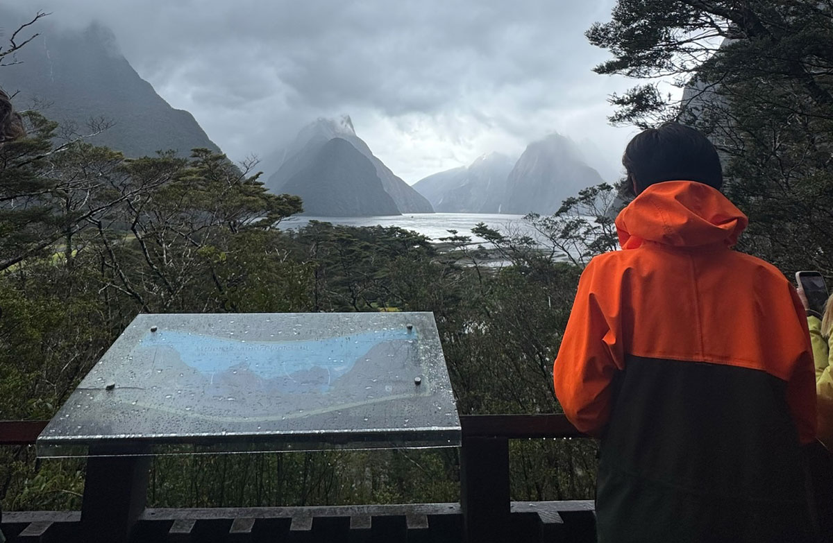
A day cruise from the Milford Sound Visitor Terminal, and a helicopter scenic flight from Milford Sound Airport, two of the ways to see the fiord listed above.
07 / The fiord in a day
How do I see the fiord in a day?
Leave Te Anau with a full tank, aim to arrive after the late morning rush, allow time to reach the terminal, then get on the water and take a short walk.
- 01Leave Te Anau ready.
DOC says there are no fuel stations or shops between Te Anau and Milford Sound, and to check the latest road status before you leave.
- 02Time your arrival.
DOC advises arriving after 1.30 pm, as traffic and parking are often busiest from 9.30 am to 1.30 pm; the journey is busiest from October to April.
- 03Allow time to reach the boat.
DOC's journey tips say to allow one hour to park and walk to the visitor terminal if you are taking a cruise. A DOC media release says 45 minutes, and Visit Fiordland says 30 minutes to park and get transport or walk to the cruise terminal. RealNZ says 45 minutes to 1 hour, and Fiordland Discovery up to 45 minutes including a 15 minute walk. We show all five.
- 04Get on the water.
RealNZ says a day cruise runs 1.5 to 2 hours on the water. If you paddle instead, keep to DOC's kayak rules above.
- 05Walk the foreshore.
Take the 400 metre Foreshore Walk loop or the Lookout Track, and carry repellent: DOC warns there may be a lot of sandflies on the Foreshore Walk and advises sandfly repellent on the Lookout Track.
- 06Know the earthquake rule.
DOC says a large earthquake could trigger a landslide generated tsunami at Milford Sound: drop, cover and hold, then move to higher ground away from the water.
- 07Expect patchy phones.
DOC's Milford area page lists Milford Sound as having mobile reception, though it is limited on the road; its journey tips list a card phone at Milford Sound. In an emergency dial 111.