
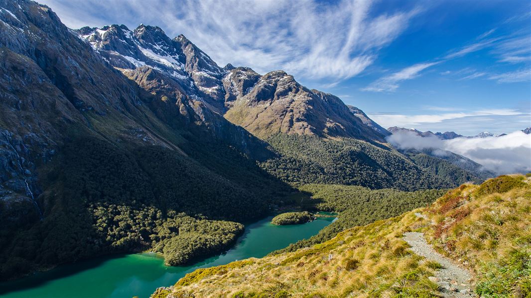
- 1DOC lists the Kepler Track as a 60 kilometre loop of 3 to 4 days, and the Routeburn Track as 33 kilometres one way over 2 to 4 days.
- 2The Hollyford Track is 56 kilometres one way to the sea at Martins Bay. DOC's track facts give 4 to 5 days; the same page's introduction calls it a 4 to 8 day tramp.
- 3Kepler and Routeburn huts and campsites must be booked in the 2026/27 Great Walks season; all six Hollyford huts must be booked in advance.
- 4DOC's avalanche page and its track pages give different avalanche windows: check the New Zealand Avalanche Advisory before you go.
01 / Choose your track
Which Fiordland track is right for me?
The Kepler for a loop from Te Anau, the Routeburn for a shorter crossing between two national parks, the Hollyford for a low route to the sea in any season.
Besides the Milford Track, DOC describes three other multi-day tracks in and beside Fiordland National Park. The Kepler Track is a loop from near Te Anau, so it needs no transport between ends. The Routeburn Track crosses from Fiordland into Mount Aspiring National Park and can be walked in either direction. The Hollyford Track runs from the Lower Hollyford Road to the sea at Martins Bay; DOC calls it an advanced tramping track, but it has no alpine sections and can be walked in any season, depending on weather. DOC does not recommend the Kepler, the Routeburn or the Milford for children under 10, because of the exposed mountain environment and often adverse weather. This guide gives DOC's facts only: no hut fees, prices or availability, which you check with DOC when you book.
02 / Side by side
How do the tracks compare?
Length and days from DOC, with the Milford Track for comparison.
| Track | Length and time, from DOC | Season, from DOC |
|---|---|---|
| Kepler Track | 60 kilometre loop, 3 to 4 days; most walkers take 4 days and 3 nights | Great Walks season 27 October 2026 to 30 April 2027 |
| Routeburn Track | 33 kilometres one way, 2 to 4 days, either direction; most take 3 days and 2 nights | Great Walks season 1 November 2026 to 30 April 2027 |
| Hollyford Track | 56 kilometres one way; track facts give 4 to 5 days, the page introduction 4 to 8 days | Any season depending on weather; no alpine sections, but flooding can affect it |
| Milford Track | 53.5 kilometres one way, one direction only, 3 nights and 4 days | Great Walks season 1 November 2026 to 30 April 2027 |
03 / Avalanche windows
When is avalanche risk on the tracks, by source?
DOC's avalanche page gives May to late October or early November; each track page says the risk can extend into December.
| Track | DOC avalanche page | DOC track page |
|---|---|---|
| Kepler Track | May to late October | Risk can extend into December; DOC may close the alpine section between Luxmore Hut and Iris Burn Hut in the Great Walks season |
| Routeburn Track | May to early November | Risk can extend into December; sections may be closed in the Great Walks season if there is avalanche hazard |
| Milford Track | May to late October | Risk can extend into December; DOC manages it to a low level in the Great Walks season, and walkers may be flown, at their cost, over dangerous sections |
When are the tracks in season?
Our Fiordland through the year guide gives DOC's dated 2026/27 Great Walks season for the Kepler, Routeburn and Milford tracks, beside the wildlife and the road through the year.
04 / Before you go
How do I prepare for a Fiordland track?
Match the track to the season and your skills, book the huts, arrange transport at each end and check the avalanche advisory.
- 01Match the season to your skills.
DOC says outside the Great Walks season the Kepler should only be attempted by fit, experienced, well equipped people with alpine, river crossing and navigation skills, and facilities are greatly reduced.
- 02Book huts well ahead.
DOC says the Kepler's three huts and two campsites must be booked well in advance in the Great Walks season, and Routeburn huts and campsites must be booked in its season. Outside the season, only Luxmore Hut on the Kepler needs a booking. All 6 Hollyford huts must be booked in advance; DOC says they have heating, mattresses and a pit toilet but no cooking facilities.
- 03Arrange transport at each end.
DOC says the Routeburn starts at Routeburn Shelter, 25 kilometres from Glenorchy, or The Divide Shelter, 85 kilometres from Te Anau, and the road distance between the two ends is 325 kilometres. For the Hollyford, DOC says the Hollyford Road leaves the Milford Road at Marian Corner, about 87 kilometres from Te Anau; allow 2 hours to drive from Te Anau to the end of the road.
- 04For the Kepler, start near Te Anau.
DOC says the Kepler Track car park is 5 kilometres from Te Anau, Rainbow Reach car park is 12 kilometres from Te Anau, and the visitor centre is a 50 minute walk along the lakefront from the track entrance.
- 05Check the avalanche advisory.
DOC says the best way to understand avalanche danger in the park is the New Zealand Avalanche Advisory from the Mountain Safety Council.
- 06Pack for the track.
On the Kepler, DOC says carry water from Luxmore Hut, because there are no reliable water sources on the alpine section until Iris Burn Hut. On the Routeburn, DOC warns of wasps and sandflies and recommends insect repellent, and antihistamines if you are allergic to wasp stings.
05 / Along the way
What will I see on each track?
Alpine views on the Kepler and Routeburn; lakes, coast and Fiordland's highest mountain on the Hollyford.
Kepler: Luxmore summit
Routeburn: two parks
The Divide
Hollyford: mountain to sea
Hollyford: the coast
See part of a track in a day
Two guided day walks from Te Anau, by their own listings: a heli-hike that lands at Luxmore Hut and walks the Kepler Track down to Lake Te Anau, and a hike on the Fiordland side of the Routeburn Track from The Divide to Key Summit.
06 / Worth knowing
What else should I know?
A race day on the Kepler, a lost hut on the Routeburn, and no phone signal.
- Kepler Challenge.
DOC says the Kepler Challenge mountain run is held on the first Saturday in December each year, when the track is busy with runners.
- No camping in the Kepler shelters.
DOC says camping or staying in the Forest Burn and Hanging Valley shelters is not permitted.
- Lake Howden Hut.
DOC says Lake Howden Hut on the Routeburn was destroyed by storm damage in February 2020.
- No signal, steep drops.
DOC says there is no cellphone coverage on the Routeburn and there are steep drop-offs along sections of the track.